

Parking in Portland
In a lot, in a garage or on the street? You make the call.
From city-run parking garages to private lots to an app for on-street parking, Portland offers reliable options for parking during your visit.
Parking Garages and Lots Downtown
The city owns SmartPark garages in the central city with roughly 4,000 public spaces across five convenient locations. Each lot displays the number of available spots above the entrance in real-time. More than 375 businesses downtown will provide a validation voucher for SmartPark parking with qualifying purchases.
Additional privately owned parking lots with varying daily, hourly, evening and weekend rates can be found throughout the central city.
On-Street Parking
In Portland’s central city, there are over 20,000 metered parking spaces. Parking hours and costs vary by neighborhood and time of day; parking is even free during some off-peak hours. Plan your parking in the downtown area or Portland’s residential neighborhoods in advance by checking the city’s public parking guide.
How to Pay for Parking
Portland offers two ways to pay for parking on the street: via a mobile app or at a pay station. The latter option uses a pay-by-plate system, meaning no more running back to your car with a paper receipt. Simply enter your license plate number and select the amount of time you wish to purchase; pay stations accept major credit cards and cash. The other option is paying via “Parking Kitty.”
Parking Kitty App
Simplify your public parking experience by using Parking Kitty. This free-to-download, city-owned smartphone app allows you to pay for parking using just your phone — no more digging for coins for the parking meter. To use Parking Kitty, download the app from the App Store or Google Play (or use the web version), then create an account within the app and set up your payment information.
The next time you’re parking, open Parking Kitty, select the zone number for the area where you’re parked, select the amount of time you’ll be parked there, and pay directly through the app. While you’re out and about, you can use the app to check how much time you have left.
Parking enforcement officers will be able to see your mobile payment with their own handheld devices, so there’s no need to worry about those parking meters. (Note that there’s a small fee for each use of Parking Kitty — 40 cents per session as of 2024.)
Parking Near Popular Attractions
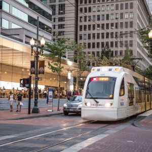
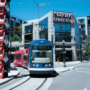
Read on for parking options near some of Portland’s must-see attractions. (Don’t forget that there are other great ways to travel in the City of Roses — from MAX Light Rail to Portland Streetcar, from bus to bicycle.) In each case below, the following applies:
- Parking in a public SmartPark garage costs $1.80/hour as of 2024 (or pay the $14–$18 “all day” rate).
- Street parking costs anywhere from $1.20 -$4/hour depending on the neighborhood and if there is an event.
- Finding a spot on the street can be challenging during peak hours.
Powell’s City of Books
- Neighborhood: The Pearl District
- Nearest SmartPark Garage: 730 SW 10th Avenue
- Walking Distance From Garage: 5 Blocks (5-Minute Walk)
- Street parking near Powell’s is an option, but it can be difficult to find a spot in the heart of the central city during peak hours.
Portland Art Museum
- Neighborhood: Downtown
- Nearest SmartPark Garage: 730 SW 10th Avenue
- Walking Distance From Garage: 5 Blocks (6-Minute Walk)
- The museum’s downtown location means finding parking on the street can take a little work, though spots are available.
Lan Su Chinese Garden
- Neighborhood: Old Town Chinatown
- Nearest SmartPark Garage: 33 NW Davis Street
- Walking Distance From Garage: 4 Blocks (4-Minute Walk)
- The garden is located in the heart of Old Town Chinatown, a bustling central city neighborhood; street parking is an option, but it might take some hunting.
Voodoo Doughnut
- Neighborhood: Old Town Chinatown
- Nearest SmartPark Garage: 33 NW Davis Street —or— 621 SW 3rd Avenue
- Walking Distance From Garage: Both = 5 Blocks (6-Minute Walk)
- Another Old Town Chinatown location means the same caveats apply when hunting for street parking near Voodoo Doughnut: spots are out there, but finding one may take some effort.
Washington Park
- Washington Park is a large complex of attractions, including the International Rose Test Garden, the Oregon Zoo, the Portland Japanese Garden, Hoyt Arboretum and more. Parking is available in lots — the specific lot you’ll want to target will vary depending on your plans, so reference the Washington Park map to come up with a plan.
- Parking in a lot at Washington Park is $2 per hour as of 2024 (or $8 for a full day).
- Please note that parking at Washington Park is extremely limited; it’s much easier to park elsewhere and travel to the park via public transportation.
More Sites and Attractions
There's far more fun to be had — and iconic sites to see — in Portland's Central City.

Governor Tom McCall Waterfront Park
Hugging the Willamette River in downtown Portland, this once bustling highway now offers a strollable, bikeable and dog-walkable public park with historical and cultural monuments, and kid-friendly fun.

Pioneer Courthouse Square
Located in the heart of downtown Portland, the city’s “living room” is close to shopping, restaurants, and hotels, and hosts hundreds of events each year.

Portland Saturday Market
Discover the Portland Saturday Market, a massive arts-and-crafts fair on the scenic Portland waterfront — shop local art, enjoy live music and taste great food.

The Oregon Jewish Museum and Center for Holocaust Education
In times of social upheaval and political uncertainty, museums like OJMCHE are more relevant than ever. Explore the rich history and ongoing resiliency of Oregon’s diverse Jewish community with interactive exhibits and experiences for all ages.
Tips for Driving in Portland
While Portland prides itself on being a city that’s easy to get around without a car, these tips will help you tour the city in four-wheeled fashion.

Driving in the Central City
One-Way and Limited-Turn Streets
When driving Downtown and in the Pearl District, you’ll notice the abundance of one-way streets. Watch the signs, and know that the one-way streets generally alternate directions.
West Burnside Street carries two-way traffic, but left turns are not generally permitted. If you need to get to the left of Burnside, plan to take two rights to get on the cross street going the desired direction.
Transit Malls
In downtown, buses, trains, cars and bikes all share the road on the Portland Transit Mall, which encompasses two one-way streets (Fifth Avenue running south, where most right turns are not permitted, and Sixth Avenue running north, where most left turns are not permitted).
Alternatives to the bus mall include Second and Fourth avenues (southbound) and Third Avenue and Broadway (northbound).
Sharing the Road
Portland’s many bike lanes, moderate climate and gentle slopes all add up to a lot of bicyclists on the roads.
While sharing the road with cyclists is usually just a matter of common sense and attention to signs, here are some tips to help smooth the way:
- Always watch for bikes. On streets without bike lanes, or when making left turns, cyclists may mix with cars in the main traffic lanes.
- Yield to bikes at intersections with green “bike boxes.” Portland has 15 such intersections, designed to prevent collisions between cyclists using bike lanes and motorists making right turns. When the light is red, drivers must stop at the white line bordering the green box, which is reserved for bicyclists. It is not legal to turn right on a red light at these intersections. When preparing to turn right on a green light, motorists should yield to oncoming cyclists in the bike lane.
- Be aware that the city is testing two other alternatives to traditional bike lanes downtown: the Portland State University Cycle Track demonstration projecton Southwest Broadway from Clay to Jackson; and buffered bike laneson Southwest Oak between Naito Parkway and Ninth Avenue and Southwest Harvey Milk Street between Naito and 13th. These roadways are clearly marked.
Major Freeways
Downtown Portland is ringed by Interstate 5, the main north-south route from Canada to Mexico, and Interstate 405, a loop that encircles Downtown and the Pearl District.
Interstate 84 originates at I-5 on Portland’s inner east side and continues east to Portland International Airport (which can be reached via the connecting Interstate 205), the Columbia River Gorge and on to Idaho and Utah. I-84 in Portland is also known as the Banfield Expressway, or just “the Banfield.”
Running west to the Oregon Coast and east to Mount Hood is U.S. Route 26. The westbound stretch is also known as the Sunset Highway and leads to Beaverton, Hillsboro and Forest Grove. Eastbound Highway 26 is dubbed the Mount Hood Highway. Mount Hood is about 55 miles from downtown Portland; the highway continues east to Nebraska.
Oregon Traffic Laws
Speed Limits
If not otherwise marked, the speed limit is 20 mph in business districts and 25 mph in residential districts. Speed limits vary on highways but are usually 55 mph or under within Portland city limits.
Turns
Left and right turns onto one-way roads are permitted even with a red light, provided you first stop and yield to traffic and pedestrians.
Cell Phone Use
Using a cell phone while driving is only allowed for adults using hands-free accessories. People under 18 are not allowed to use any mobile communication device while driving; this includes texting or talking on a cell phone, even with a hands-free accessory. Talking or texting without a hands-free accessory is illegal for individuals of any age.
Car-Free Transportation
Ditch your wheels and explore the city via public transportation, bicycle, e-scooter and more.


Was this page helpful?