
 Search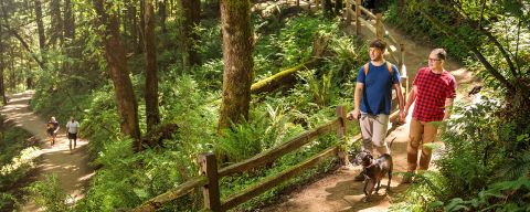

Top Hikes in and Near Portland
From city hikes to epic waterfalls, coastal views and so much more, these are the best hikes near Portland.
The Pacific Northwest draws visitors from all over, enticed by the scenic coastline, verdant valleys and breathtaking mountains. The beautiful Willamette River runs through Portland’s city center, and the mighty Columbia River serves as Oregon’s northwest border. We have parks on extinct volcanoes, Mt. Hood to the east and the Oregon Coast to the west.
All this easy access to the great outdoors makes Portland a perfect destination for hikers of all levels. Enjoy urban walks and hiking trails in forested parks and lush gardens scattered throughout the city, or take a short drive to explore alpine lake hikes near Mount Hood, and waterfall trails in the Columbia River Gorge. You can’t go wrong with any of the best hikes near Portland.
Things to Know About Hiking Around Portland
What can I check for trail closures?
Where can I hike with my dog in Portland?
Where do I need a parking pass or permit?
What are the best hikes within an hour of Portland?
Where can I find information about accessible trails?
What are some short and easy hikes in Portland?
Tualatin River Wildlife Refuge southwest of Portland offers a short walk along the Tualatin River and close-up views of migratory birds that stop over in the surrounding wetlands.
North of downtown on Sauvie Island, you’ll find many short-but-sweet walks, like Oak Island Nature Trail or Wapato Access Greenway Trail.
What are some difficult hikes in Portland?
What are some lesser-known or less popular hikes where I might see fewer people?
Where To Hike
With so many options from the city to the Gorge, the mountains or the coast, it can be intimidating to decide where to hike. The options are seemingly endless, and there are practically no wrong answers. If you’re visiting between November and June, you can likely eliminate Mt. Hood due to winter elements, including snow. If you only have a few hours, stick to hikes in Portland and save longer trips to Mt. Hood or the Oregon Coast for another day.
Hikes in and near Portland offer a good variety in terms of difficulty, distance and accessibility. As you venture into the Gorge and Mt. Hood, you’ll find more challenging hikes, with steeper climbs and expansive views.
Getting There & Parking
Portland and surrounding trailheads are generally accessible by car. As a very rough rule of thumb, hikes in Portland, the western Gorge and the Willamette Valley should be reachable in an hour or less, while the best coastal and Mt. Hood hikes will usually take two hours of drive time each way, making them a great full-day option with other attractions as well.
Within the city, parking requirements should be limited to free or fee-based parking. Some trailheads, particularly on federal lands around Mt. Hood, the Columbia River Gorge and the Oregon Coast, require a Northwest Forest Pass or other recreation pass. Check the managing agency’s website before you go.
For the easiest parking and least crowded trails, arrive early (or late) and consider carpooling when possible. Peak season weekends between mid-morning and mid-afternoon will see the biggest crowds.

Credit: Mike Drewry from Hoyt Arboretum and Friends
TriMet public transit system can get you to the best hikes in Portland on most days of the week, with some route planning. Getting out of the city does not necessarily mean you must have a car, either. Shuttle services such as Gray Line and Sasquatch Shuttle operate in the Columbia River Gorge and the Mt. Hood Express runs daily along Highway 26 from Sandy to Government Camp and Timberline Lodge. There’s even tours that combine the Gorge and Mt. Hood, though you’re less likely to have much time for hiking.
Great Hikes in Portland
While the wide sidewalks (and short blocks) of downtown make for pleasant strolling, Portland comes alive for hiking enthusiasts when you get into the “urban wilderness” and trails that make this city green from any angle.
A Hiker's Paradise
The many trails and natural spaces throughout the city provide a quick escape from the attractions that fill Portland’s neighborhoods.
Forest Park
At 5,100 acres (2,064 ha), Forest Park is one of the largest urban forests in the United States. More than 80 miles (129 km) of trails cover Portland’s West Hills with forested hikes from 40 unique access points. Find a guide and maps to plot your course and explore Portland’s prized urban forest.

Credit: NASHCO Photo
A National Recreation Trail, Forest Park’s Wildwood Trail stretches for more than 30 miles (48.3 km) from the Newberry Road Trailhead to the Wildwood Trailhead near the Oregon Zoo. The Wildwood Trail’s highest point is at the historic Pittock Mansion, and the southern part of the trail passes through Washington Park and Hoyt Arboretum, which showcases 2,000 species of trees and shrubs and 2 miles (3.2 km) of wheelchair-accessible trails among its ample hiking terrain.
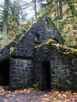
From the fields of Macleay Park in Northwest Portland, it’s less than a mile (1.6 km) to the Wildwood Trail. Once you pass the Stone House, known to Portlanders as the “Witch’s House,” you can ascend to Pittock Mansion or explore one of the seven loop trails of varying lengths that will take you into the forest and through neighborhood streets.
Credit: Nick Mendez
If you start at Macleay Park, the nearly 6-mile (9.6 km) out-and-back hike up to the Pittock Mansion is rated “moderate” and has a 950-foot (290 m) elevation gain. This route follows the Wildwood Trail through the Bird Alliance of Oregon (formerly Portland Audubon). For a shorter trek with no switchbacks, try a 4-mile (6.4 km) out-and-back from Washington Park that offers many undisturbed views of the city and Mount Hood.
Oaks Bottom Wildlife Refuge
Minutes from downtown Portland, between the Willamette River and Sellwood-Moreland, Oaks Bottom Wildlife Refuge is a haven for birds and walkers. The park’s Bluff Trail connects to the Springwater Corridor on the Willamette for a 2.3-mile (3.7 km) loop that offers views of marshland favored by scores of great blue herons, as well as the vintage rides of Oaks Amusement Park.

Powell Butte Nature Park
The views from Powell Butte, an extinct cinder cone volcano, will not disappoint. On a clear day, you can see five peaks in the Cascade Range, from Mount Rainier in the north to Mount Jefferson in the south. These 611 acres (247.3 ha) of meadowland and forest — home to birds of prey, gray foxes, skunks, bats and mule deer — offer over 9 miles (14.5 km) of trails for mountain bikers, hikers and horseback riders as well as a 0.6-mile (1 km) paved accessible trail. This park is gated, so be sure to check the seasonal hours before you hit the trail.
Kelley Point Park
Kelley Point Park is at the very tip of North Portland, where the Willamette and Columbia Rivers converge. For a scenic sunrise, take the Kelley Point Loop trail. Mount Saint Helens and Mount Hood make cameo appearances at points along the 1.7-mile (2.7 km) loop through a cottonwood grove. Keep your eyes open for seabirds, and settle down by the water’s edge.
Tryon Creek State Natural Area
Along Portland’s southwest border lies Tryon Creek State Park, a 658-acre (266 ha) forest featuring 8 miles (12.9 km) of hiking trails, a 0.3-mile (0.5 km) accessible trail and a nature center. Tryon Creek wends through the park, with many wooden bridges offering views from above.
Kid-Friendly Hikes
Some of the best hikes near Portland are under 4 miles (6 km), in or close to the city and bursting with natural beauty.
City Hikes
The 4T Trail is a self-guided tour that lets you explore the city — and see some of the best views — without a car. Instead, you’ll rely on the 4 T’s: trail, tram, trolley and train. The tour takes about four hours, five dollars and a bit of leg power. The route is well marked with signs and involves about 2.5 miles (4 km) of walking.
For more urban ambles, enjoy the sculptures, fountains and gardens along the riverside Vera Katz Eastbank Esplanade, Tom McCall Waterfront Park, South Waterfront Park, Willamette Park and Sellwood Riverfront Park. Many of these areas include crossings over the bridges of Portland.

Credit: Diego Diaz
Explore More of Portland
These parks, trails and places help you experience the natural beauty of the Pacific Northwest.





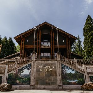

Hiking the Columbia River Gorge
If you’re looking for the best hikes near Portland, it’s almost impossible to imagine a visit that skips over the Columbia River Gorge National Scenic Area. Heading a short drive east on Interstate 84 brings you to the city of Troutdale and the western gateway to the gorge. A few minutes further, and you will begin to grasp the scale and grandeur of your day ahead.
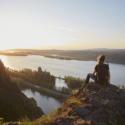
Across 80 miles (128 km) of length and 4,000 feet (1,219 m) of depth, the gorge offers dramatic ecological diversity from east to west, transitioning from forested waterfalls to an arid landscape and wind turbines. Countless waterfalls, windsurfers, kiteboarders, cyclists and charming towns like Cascade Locks and Hood River lie ahead, along with some of the best dayhikes you will find anywhere.
Waterfalls
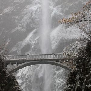
The iconic and accessible Multnomah Falls is just the start. The gorge offers multiple trails to some of the most beautiful waterfall hikes near Portland, including Latourell, Wahclella, Shepperd’s Dell, Bridal Veil, Horsetail and Elowah. In some places, the falls can be viewed mere yards from the parking areas. In others, enjoy a hike first — some up to 6 miles (9.6 km) or more. Closer to Portland, the Eagle Creek Trailhead offers trails to more waterfalls, like Tunnel and Punchbowl Falls.


The trails to the waterfalls can often be crowded, but there are plenty of breathtaking views to find. Choose the moderate, nearly 5-mile (8 km) round-trip trek to Angel’s Rest, the over 7 mile (11 km) loop trail at Cape Horn with stunning views of the river, or the 1.8-mile (2.9 km) trail exploring Beacon Rock. Use the Friends of the Columbia Gorge website to help plan your trip.
Sunrises and Wildflowers
Rowena Plateau has it all: flowers, wildlife and gorgeous Columbia River Gorge views, and a memorable sunrise for the early risers. Clocking in at a little over 2 miles (3.2 km) out and back, this plateau hike is ideal for those seeking minimal exertion while reaping maximum sunrise rewards. It’s a doable hike for families; unfortunately, your furry friends will have to stay home for this one.
Dog Mountain is an enduring favorite of Portlanders despite its Washington state locale. While the full length of the hike stretches 7 miles (11 km), for a hike this early, we recommend stopping off at the lower viewpoint 1.5 miles (2.4 km) in to watch the sunrise from an elevation of 1,600 feet (488 m). Marvel at the Columbia River glittering below and the blooms during wildflower season. In addition to the Northwest Forest parking pass required to leave your car near the trailhead, each hiker must purchase a $1.50 permit on the weekends between March 31 and July 1.
Mount Hood Hikes
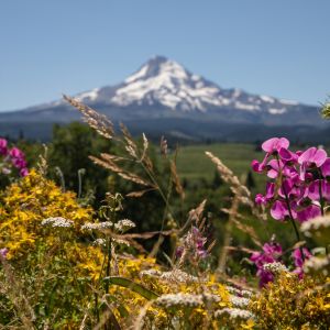
The slopes of Mount Hood are famous for great wintertime sports, but Mt. Hood National Forest’s wooded splendor also offers a number of the best hikes near Portland for warmer seasonal enjoyment, from what is typically mid-July through October.
Roughly 70–90 minutes from Portland via Interstate 84 and Highway 26, the most direct route takes you through the villages of Welches, Zig Zag and Rhodedendron before arriving at Government Camp, a classic mountain town that serves as a recreation hub. A more meandering two-hour route follows Interstate 84 eastbound through the Columbia River Gorge and Highway 35 southbound through the Hood River Valley.


Try easy to moderate loop hikes at Trillium Lake, Mirror Lake or Timothy Lake for great views. Hike to the beautiful Tamanawas Falls on an easy and relatively kid-friendly 3.4-mile (5.5 km) round-trip or to the majestic Ramona Falls via a moderate 7.4-mile (11.9 km) loop. Marvel at the old-growth trees along the Salmon River Trail, with multiple access points allowing for hikes as short as 1 mile (1.6 km) or as long as 8 miles (12.9 km). From more great paths among old-growth forests, try the Wildwood Recreation Area, which is open from spring to fall and connects to several trailheads with hikes from 4 miles (6.4 km) to 10 miles (16 km) in length.
Lost Lake
If your family is looking for some crisp mountain air, try the loop trail around Lost Lake while taking in Mount Hood’s mesmerizing reflection. Avoid the usual summertime crowds by making the effort to get out early; you’ll be rewarded with front row seats to the rosy rays of dawn creeping over Mount Hood and reflecting on the 245-acre (99 hectare) lake below. This 3.2-mile (5 km) loop is easy enough that even sleepy kiddos will be impressed.
Timberline Trail
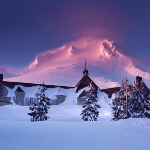
From the iconic Timberline Lodge, you can dayhike in either direction along the Timberline Trail. Advanced backpackers should definitely consider completing the full loop, which circumnavigates the mountain, offering vistas, waterfalls, alpine meadows and forests over 40 strenuous miles. Significant preparation is recommended as water can be scarce, navigation can be challenging, and trail conditions including river crossings and weather can change quickly.
Hiking Saddle Mountain and Silver Falls
Head 70 miles (113 km) toward the Oregon Coast for eye-popping 360º views from Saddle Mountain’s 3,290-foot (1,003 m) summit. Although steep at times, the 2.5-mile (4 km) hike to the top promises majestic views of the Pacific Ocean’s blue expanse, Washington’s Mount Rainer and everything in between. If your schedule allows, complete the short drive to Seaside or Cannon Beach in time to watch the sun set over the Pacific.
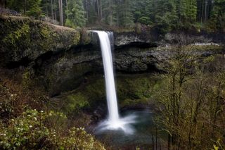
Credit: Kelvin Kay via Flickr
Situated 54 miles (86.9 km) south of Portland in the Cascade foothills, Silver Falls State Park is the largest state park in Oregon. The park includes two day-use areas, a campground and a number of scenic waterfalls. To see them all, hike the Trail of Ten Falls, a moderate 8-mile (13 km) loop. This roughly three-hour hike is a designated National Recreation Trail and allows visitors to walk directly behind four different waterfalls. On your way back to Portland, find reason to take the scenic route via Silverton and The Oregon Garden.
Mentioned Elsewhere Online
Favorite local hikes in Portland and the surrounding region.
A hub for all things gorge, from conservation to trail info.
Trails for All Seasons and Hikers
Find the perfect trail for any time of year, for everyone in your group.



Get Out of Town
Find fresh air, flowing water, magnificent mountains and breathtaking views.
Mt. Hood: A Four-Season Adventure Guide
Explore Mt. Hood — the tallest peak in Oregon — with this in-depth guide that covers weather, what to pack, where to stay, outdoor recreation and how to have an unforgettable experience.
What to Do in the Columbia River Gorge
With an emerald backdrop and riverside paths, outdoor adventure awaits.
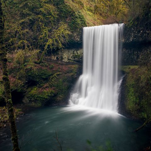
Silver Falls State Park
Famous for its abundance of picturesque waterfalls, Silver Falls State Park is the largest state park in Oregon at 9,200 acres (3723 hectares) and one of the most popular.
Was this page helpful?