

Jim Kettner
Jim Kettner is a coffee shop cartoonist, writer, illustrator and podcaster. Read More
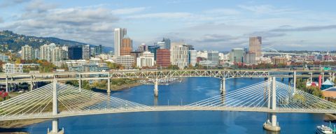
Bridges of Portland
Learn the history and key features of the city’s 12 Willamette River bridges.
Jim Kettner
Jim Kettner is a coffee shop cartoonist, writer, illustrator and podcaster. Read More
Portland’s “Bridgetown” moniker is no exaggeration. The Willamette River, which divides the city east and west, features a dozen distinct crossings that hint at the city’s eclectic personality. Locals celebrate them with all kinds of knickknacks and apparel, including T-shirts, coffee mugs and designer jewelry.
Every summer, visitors and locals alike celebrate with the annual Providence Bridge Pedal event. Participants can choose anything between a 5-mile (8 km), two-bridge walk to an epic, 37-mile (60 km) bike ride crossing 11 bridges. Other biking events like Pedalpalooza or the World Naked Bike Ride also let you ride en masse across many of the city bridges.
If you’re keen to pedal (or just looking for a great photo op), here’s a quick primer on what Bridge City has to offer.
St. Johns Bridge (1931)
Towering above all its southern neighbors, the 408-foot (124 m) St. Johns Bridge is the sole suspension bridge in the Willamette Valley. Its dual gothic-style towers inspired the name of the neighboring Cathedral Park.
Best way to cross: Bike, foot, bus or car.

Credit: Travel Oregon / Mountains Legacy
Burlington Northern Railroad Bridge (1908)
The Burlington Northern Railroad Bridge, also known as the St. Johns Railroad Bridge, is exclusively for locomotives, but visitors can still enjoy seeing Amtrak and Union Pacific trains glide over the rails of this vertical lift truss bridge.
Best way to cross: No public access.
Fremont Bridge (1973)
Resembling nothing so much as the sloping tracks of a modernist rollercoaster, the Fremont Bridge is the second-largest tied-arch bridge in the world. This bridge isn’t an option for pedestrians or cyclists, but eight double-decker lanes connect North Portland with downtown via Interstate 405 and US 30.
Best way to cross: Car only.

Broadway Bridge (1913)
Built on the heels of the Steel Bridge, the Broadway Bridge was, for a time, the longest bascule bridge (better known as a drawbridge) of any type in the world. Repainted in 1963 from basic black to an eye-catching “Golden Gate” red, the Broadway Bridge’s four lanes and sidewalks carry motor vehicles, bikes, pedestrians and the Portland Streetcar from Lloyd on the eastside to the foot of Union Station on the west.
Best way to cross: Bike, foot, streetcar or car.
Steel Bridge (1912)
One of the most visually distinct bridges in Portland, the Steel Bridge rises like an epic-scale erector set over the Willamette River. Connecting the westside neighborhood of Old Town Chinatown and the eastside destination of the Rose Quarter, the Steel Bridge’s double-decker construction allows for a diverse spectrum of traffic: automobiles and MAX light rail trains ride up top, while the lower deck accommodates freight cars, Amtrak, pedestrians and cyclists. It’s no wonder The Oregonian called it the hardest-working bridge on the river.
Best way to cross: Bike, foot, MAX light rail or car.
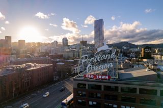
Burnside Bridge (1926)
Used by motor vehicles, bicycles and pedestrians alike, the Burnside Bridge is distinctive for its Italian Renaissance-style towers. It also offers an incredible view of the illuminated White Stag “Portland Oregon” sign on the west side, as well as its neighboring bridges to the north and south.
Best way to cross: Bike, foot, bus or car.
Credit: Justin Katigbak, Travel Portland
Morrison Bridge (1958)
The current Morrison Bridge is a 1958 update of its 19th-century predecessor. Its LED system decorates the river with dazzling multi-color displays, courtesy of the Willamette Light Brigade. Pedestrians and cyclists rejoiced when the notoriously tricky-to-navigate bridge added a pedestrian pathway in 2009.
Best way to cross: Bike, foot, bus or car.
Hawthorne Bridge (1910)
Rising from the ashes of the original Madison Bridge (which was destroyed in a 1902 fire), the Hawthorne Bridge is the oldest vertical-lift bridge still in operation in America. In 1998, the city funded a $22 million upgrade, including a new coat of nontoxic paint and wider sidewalks, making it the busiest bicycle transit bridge in the city. The Hawthorne became even better for pedestrians and cyclists in 2001 when it was connected to the Eastbank Esplanade and Springwater Corridor on the Willamette trails.
Best way to cross: Bike, foot, bus or car.

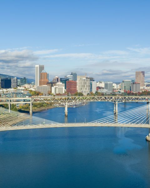
Tilikum Crossing (2015)
The newest addition to the Bridgetown family is Tilikum Crossing; a cable-stayed bridge. Named for the local Chinook tribe’s word for “people,” the Tilikum is unique among its fellows, as it is the only bridge in Portland not open to private motor vehicles. Instead, the Tilikum was designed to accommodate the rapidly growing number of pedestrians and cyclists, as well as public transit. The bridge connects commuters and visitors alike to the Portland Aerial Tram and the West Hills to Central Eastside favorites like the Oregon Rail Heritage Center and OMSI.
Angles formed by the cables mirror the outline of Mount Hood, which rises in the background. There are nods to nature, too, with osprey nesting poles at either end and a “sonic dish” art installation on the east bank that amplifies the sounds of the river. The easy accessibility, along with an LED system illuminating the modernist cable-stayed construction, makes the “Bridge Of The People” a must-see.
Best way to cross: Bike, foot, MAX light rail or streetcar.


Marquam Bridge (1966)
This utilitarian double-decker Marquam Bridge may be the ugly duckling of the Bridgetown family, but what the concrete and steel construction lacks in beauty, it makes up for in effectiveness; carrying nearly 136,000 motor vehicles a day via Interstate 5. The automobile-only Marquam is the busiest bridge in all of Oregon.
Best way to cross: Car only.
Ross Island Bridge (1926)
The Ross Island Bridge was yet another addition to the “bridge boom” of the 1920s. This bridge stands apart from the many vertical lift and drawbridges on the Willamette due to its sturdy cantilever truss construction. Like the Broadway Bridge, the Ross Island Bridge got a 1960s makeover, going from black to blue.
Best way to cross: Bus or car.
Sellwood Bridge (2016)
Originally opened in 1925, the Sellwood Bridge is the latest span in Portland to get a major overhaul: Construction was completed in 2016 on a new bridge to better accommodate cars, pedestrians and cyclists. Portland’s southernmost bridge, the Sellwood connects the eastside to Southwest Portland and is the busiest two-lane bridge in all of Oregon.
Best way to cross: Bike, foot, bus or car.
Learn More About Portland’s Bridges
How many bridges are there in Portland?
Which bridges can you walk across?
St. John’s Bridge
Broadway Bridge
Steel Bridge
Burnside Bridge
Morrison Bridge
Hawthorne Bridge
Tilikum Crossing
Sellwood Bridge
Which Portland bridge is the oldest?
The oldest bridge not exclusively used by trains is the Hawthorne Bridge (opened in 1910). In fact, the Hawthorne Bridge is the oldest vertical lift bridge in America that’s still in operation.
Getting Around Portland
Navigating Portland is a breeze with these transportation options.
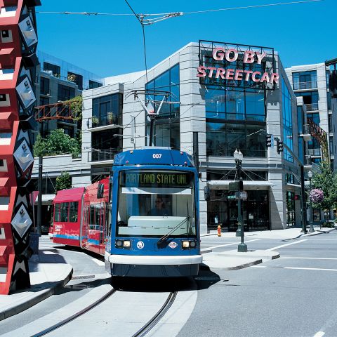
Portland Streetcar
The City of Roses built the nation’s first modern-day streetcar in 2001: the sleek and modern Portland Streetcar.
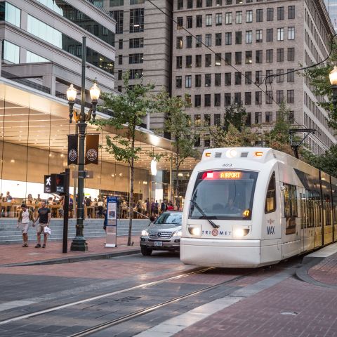
MAX Light Rail
Portland’s efficient light rail system connects the metro area and downtown core. Learn how to ride and where to go on MAX.

Biking
One of the best ways to explore the Rose City is on two wheels.https://en.wikipedia.org/wiki/24_Hour_Party_People
Was this page helpful?