

Biking
One of the best ways to explore the Rose City is on two wheels.
With miles of protected bike lanes (many of which are adorned with special designs), one of the world’s largest naked bike rides, and even a months-long bike festival every summer, Portland is a bicyclist’s dream city.
Bike-Friendly Portland
Pedaling through Portland on two wheels is a summertime must. With almost 400 miles (650 km) of bikeways woven throughout the city, Portland is consistently listed as one of the most bike-friendly cities in America.

Portland’s bikeways are made up of bike paths, designated bike lanes and neighborhood “greenways” where bicycles and pedestrians are given priority over cars. In just a few minutes, cyclists can go from riding beneath a canopy of trees in Ladd’s Addition to biking along the Eastbank Esplanade and watching the sunset over the Willamette River.
Want a guide to help you hit the bike lanes? Portland offers plenty of bike tours to let you see the city like a local.
Bike Rentals and Bike Sharing
If you don’t have your own wheels, getting around Portland like a local has gotten much easier since the 2016 arrival of the bike-share program Biketown. You can also check out one of Portland’s many bike rental services.
Get into Gear at PDX Bike Shops
These Portland bicycle shops offer rental services and safety gear for your bike trips.
Biketown, Portland’s bike-sharing service, offers over 3,000 bright orange e-bikes for hop-on rental at over 240 stations around town for easy cruising.
Know Before You Go
You can create an account via the Biketown website or app before your visit, making it easy to rent and roll when you arrive.

Credit: TriMet
Biketown’s 1,000 bright orange, eight-speed bicycles are equipped with integrated baskets, front and rear lights and reflective paint jobs. They also carry communications, payment and locking technology, making them easy to find, reserve, park and ride throughout the central city.
How to Use Biketown
The best option for visitors is to pay as you go. After paying a one-time $5 sign-up fee, you’ll be charged 8 cents per minute ($2.40 for 30 minutes of use). You can use up to four bikes per account.
Riders can check out bikes at one of 20 kiosks or via the Biketown website or free smartphone app. When you’re done riding, you can lock the bike at any Biketown station in the service area.
Adaptive Biketown
Biketown has partnered with local bike shop Nomad Cycles to offer Adaptive Biketown, a program dedicated to increasing access to adaptive bikes for those with disabilities. To learn more about the program and rent a bike, visit the website or drop by Adaptive Biketown’s Central Eastside outpost, which is located next to the Oregon Museum of Science and Industry (OMSI) at 1945 SE Water Ave., Building B. It’s a big red barn with a convenient Central Eastside location, handy to the Eastbank Esplande, Tilikum Crossing, and other Southeast Portland attractions and eateries.


They’re open Wednesday–Sunday, 11 a.m.–5 p.m. (closed Monday–Tuesday). They accept walk-ins, or you can set up your rental for a future time. You can also schedule an appointment by emailing the Adaptive Biketown team at adaptive@nomadcyclespdx.com. Your rental includes a fitting, bike tutorial and helmet — and best of all, the first rental hour is free!
Bicycle Maps & Where to Ride
Maps & Resources
The Portland Bureau of Transportation offers great resources for cyclists. There are many maps for those who want to explore the city and region via their bike lanes. Cyclists who crave a journey off the beaten path should venture to the Columbia River Gorge, where there are easy, moderate and challenging rides for everyone to enjoy.

Credit: Catalina Gaitan
Portland Biking Maps and Routes
Use the links below to find fun and safe rides throughout Portland.
Portland Bike Maps
Free biking and walking maps produced by the Portland Bureau of Transportation (PBOT).
Bike Maps for the Greater Portland Region
Mobile-friendly, user-generated bike routes through Portland.
Nine Best Rides Around Portland
Maps of looped routes featuring low-traffic streets, neighborhood greenways, off-street paths and bike lanes.
Best Parks for Cycling
Explore these local outdoor attractions on two wheels.
Bike Safety Tips
Stay safe! The Portland Bureau of Transportation provides a page with all the relevant state and city laws pertaining to cyclists.
Know Before You Go
Portland city ordinances prohibit riding bicycles on sidewalks in the downtown area bounded by SW Jefferson Street, SW Naito Parkway, NW Hoyt Street and 13th Avenue.
Sharing the Road
Most Portland drivers are comfortable sharing the road with bicyclists — in fact, many of those drivers are counting the hours until they can get on their own bikes and ride. However, it’s still a good idea for cyclists to be careful and ride defensively. Some Portland streets are geared more toward cyclists than others, so it’s a good idea to review the biking and walking maps from the Portland Bureau of Transportation.
Bike Boxes
Portland has 15 intersections with green “bike boxes.” These are designed to prevent collisions between cyclists using bike lanes and motorists making right turns. Here’s how they work:
- When the light is red, bicyclists should stop inside the green box. (Motorists must stop at the white line behind the box.)
- Bicyclists can turn right on a red light at bike box intersections; drivers cannot.
- Bicyclists have the right of way on a green light.
Biking Beyond Portland
Explore gorgeous areas outside Portland by bike using these handy guides.

Bicycling the Banks-Vernonia State Trail
The small logging town of Vernonia has become a central hub for bike routes through the surrounding state forest.
What to Do in the Columbia River Gorge
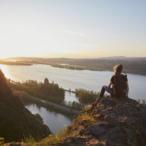
Just 30 miles (48 km) east of Portland sits the Columbia River Gorge — a rugged canyon on the broad Columbia River and home to more than 90 waterfalls, countless hiking trails, plenty of water sports and several charming communities.

Guide to Gresham
Looking to venture off the beaten path like a Portlander? This neighboring town is where locals go to slow down, stroll through quaint historic architecture and feast on international fare.
Biking Events
Bike-loving Portlanders have come up with all sorts of rides and events that fill the calendar with two-wheeled shenanigans. Read on for our top biking events, and check out BikePortland for more Portland-based biking news and upcoming events

Pedalpalooza
June-September
For the expansive months in the summer, bike geeks organize about 200+ events to celebrate all that is cycling during Pedalpalooza. There’s a major menu of rides, performance art, races, taco stand tours, gay pride bike parades, theater performances, bike polo and more.

Credit: Brad Reber
Portland’s World Naked Bike Ride
August
The World Naked Bike Ride is a global event, with rides held in 74 cities from Amsterdam to Perth, but Portland lays claim to the world’s largest ride, drawing over 10,000 cyclists clad in various combinations of swimsuits, underwear, body paint and smiles in 2014. And don’t worry, riding naked in Portland is legal; the event is considered a protest and, therefore, nudity is permitted under Oregon’s liberal free speech laws.
In 2025, there will be two naked bike rides: the Portland World Naked Bike Ride and the World Naked Bike Ride Portland. Go “as bare as you dare” — twice!

Credit: Friends on Bikes
And More
For more info on Portland biking news, community and events, visit BikePortland.org and Shift2Bikes.org. The bike community participates in long-range scenic rides, mountain biking and more.
Upcoming Biking Events
Enjoy the city's biking culture with these upcoming events.
Go By Bike
Explore Portland and the surrounding region on two wheels.
Bicycling the Banks-Vernonia State Trail
The small logging town of Vernonia has become a central hub for bike routes through the surrounding state forest.

Pedalpalooza Bike Festival
Portland’s cycling culture peaks each summer during the months-long Pedalpalooza bike festival, featuring 100+ local-led, themed rides, all open to the public.
Was this page helpful?